Facing the unfriendly street
Mapping critical walkability factors of elderly people walking with a Rollator, in the outdoor public space of Amsterdam the Netherlands.
MSc Colloquium by: Niene Boeijen
What will I tell you?
Introduction
Municipalities responsible
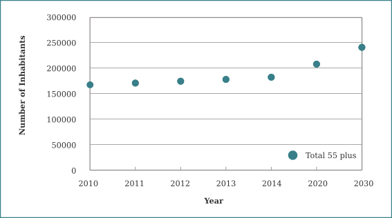
Higher demand, less funds
Asks for new solutions
Let elderly live independently as long as possible
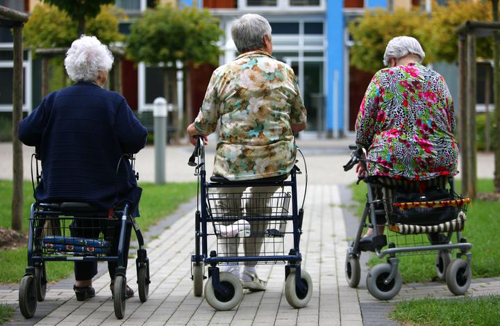
Living independently means being mobile for personal care and have access to the public space for grocery shopping, social contacts and physical activity.
The quality of the immediate environment is a significant determinant of elders well-being, independence and quality of life.
Problem definition
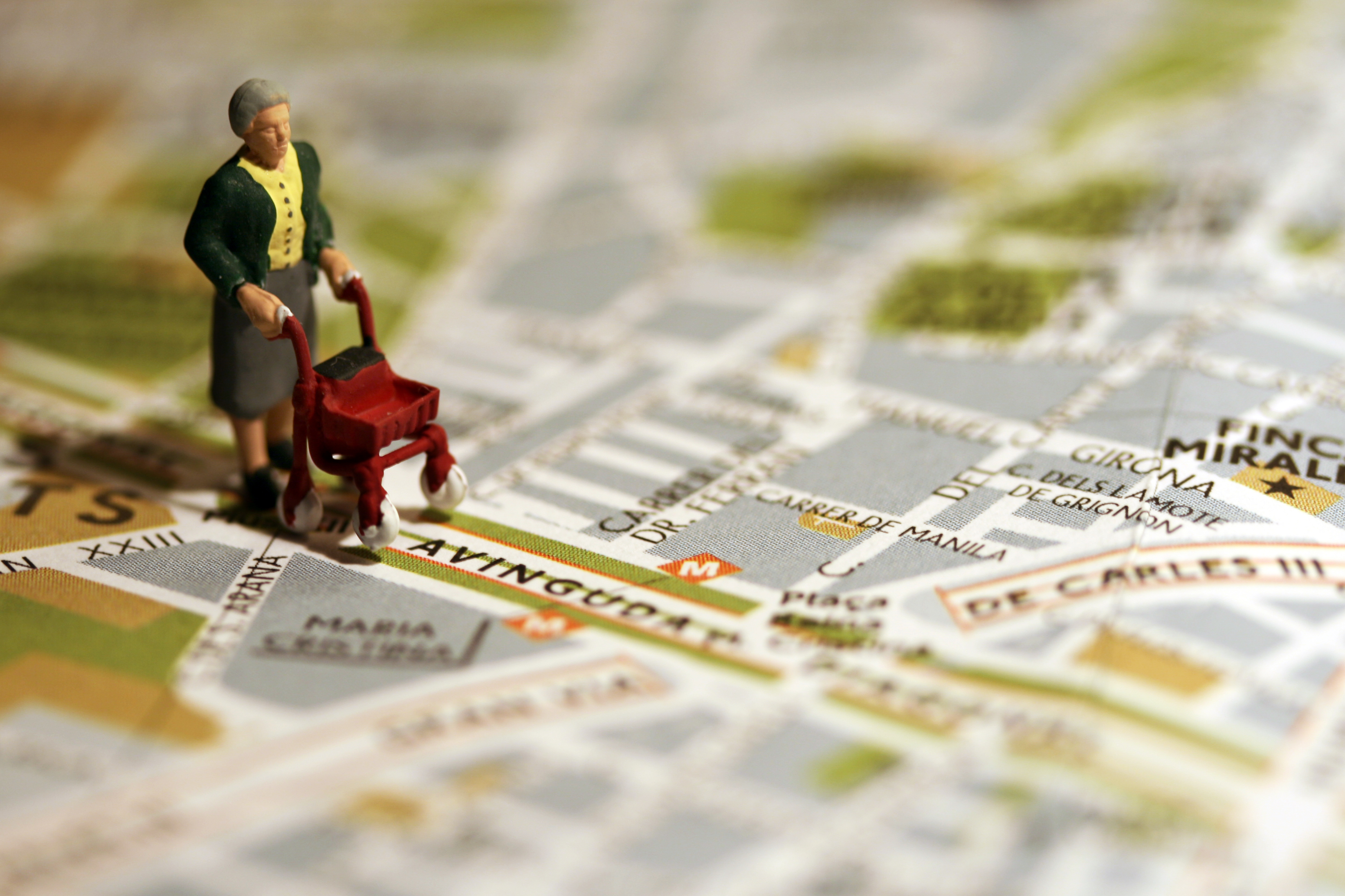
The forgotten pedestrian
policy, research, data
The vicious circle of no data- no awareness - no priority - no research - no data, needs to be broken.
GIS can help to map and study the environment and neighbourhood characteristics that influences outdoor walkability quality among older people and by doing so, fill a bit of the knowledge gap
Objective
Analyse and visualize geodata to explore the critical walkability factors for elderly depended on a rollator in the urban outdoor space.
Research Questions
- What are the critical walkability factors hindering elderly with a rollator in the outdoor environment?
- Which existing geodata can be used to map and analyse these critical walkability factors?
- What geodata can be collected with a smart walker to map and analyse these critical walkability factors?
- How can the available and measured geodata be compared?
1. Finding the Critical Walkability factors
Literature research
Interviews
Top 3 found walkability factors:
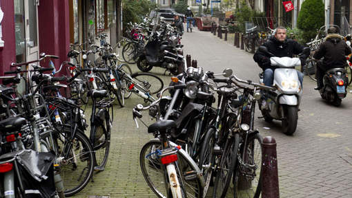
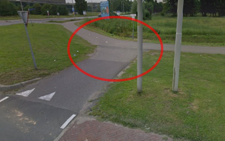
Wrongly parked bikes and cars
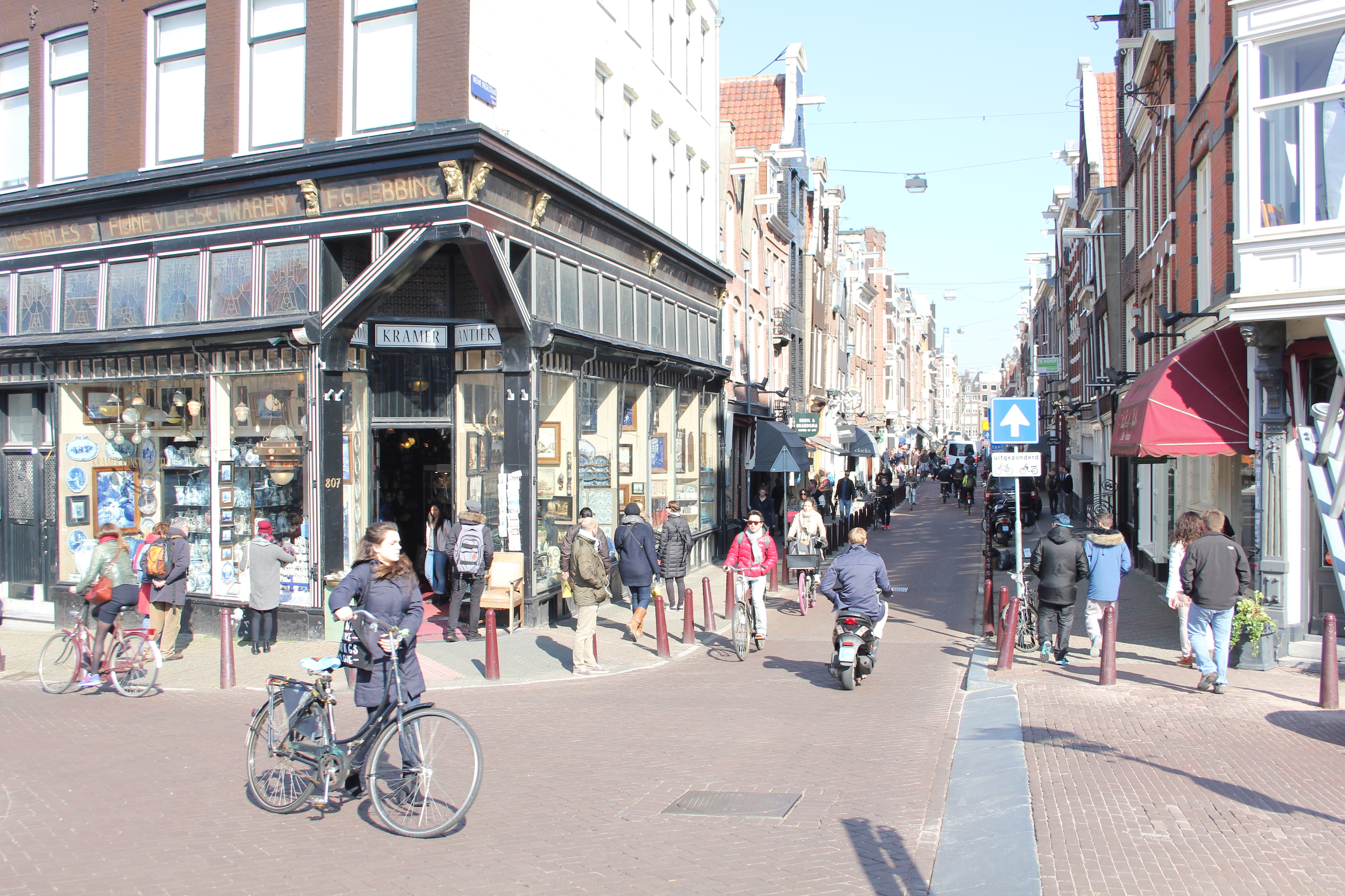
Sloping pavements
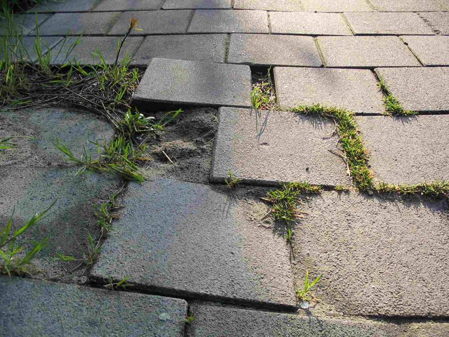
Irregular pavement, cobbled surfaces or bad maintenance
Literature research
Interviews
Top 3 found walkability factors:
Wrongly parked bikes and cars
Sloping pavements
Irregular pavement, cobbled surfaces or bad maintenance
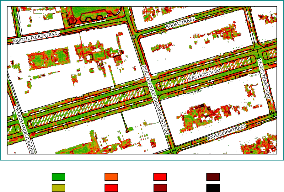
2. Mapping walkability with available geodata
Mapping irregular surfaces
Mapping slope
AHN2
4% slope
3. Mapping walkability with collecting geodata
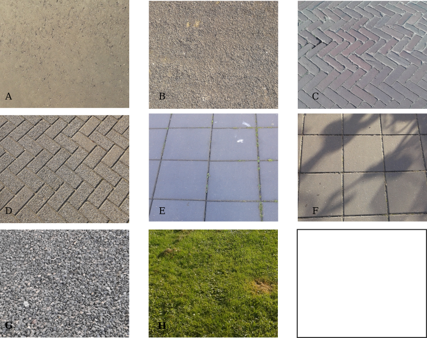
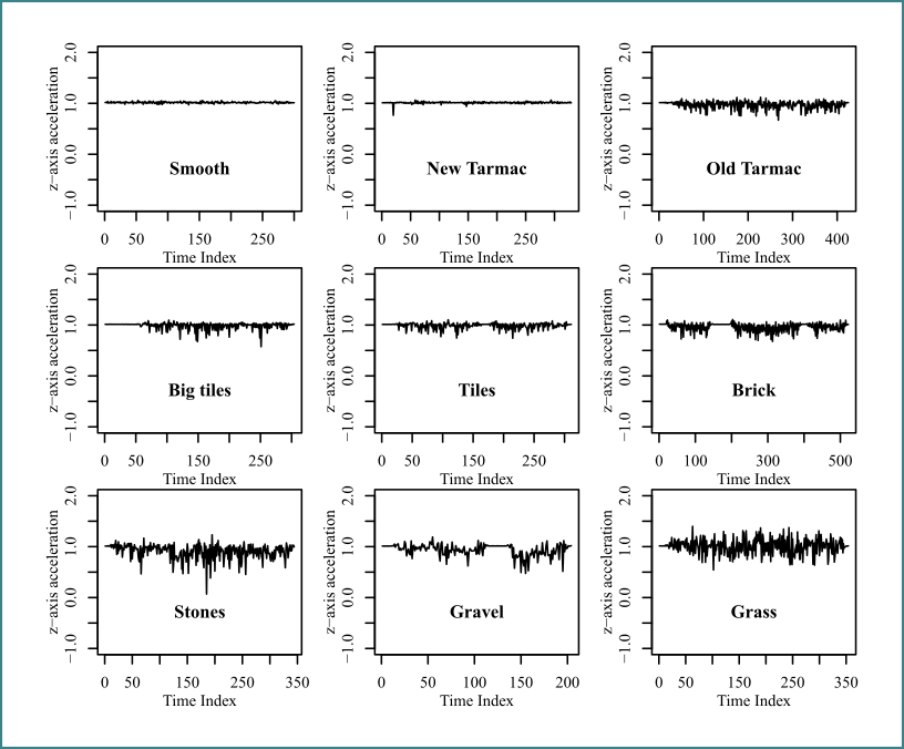
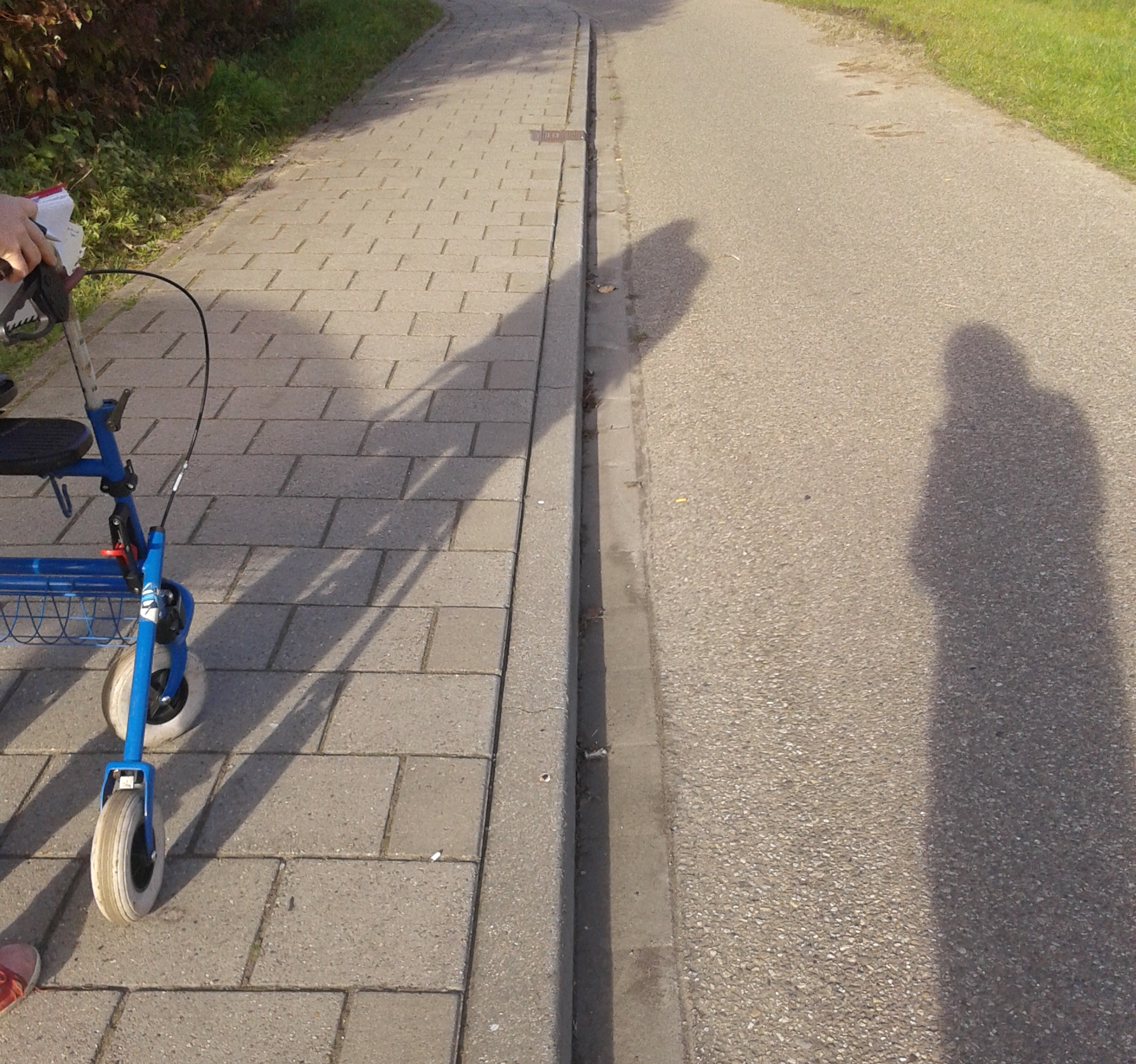
Mapping irregular surfaces
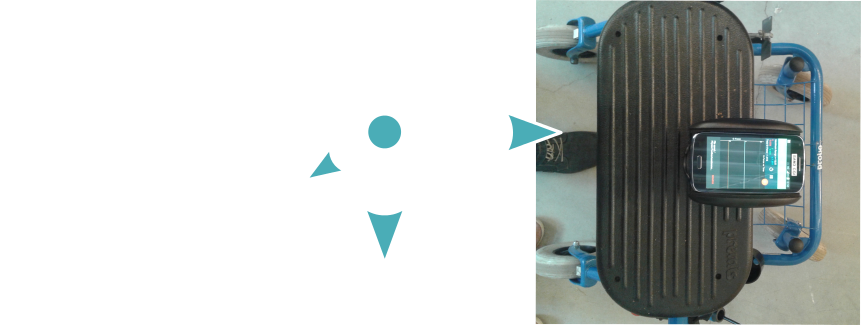
Using an accelerometer
Set-up Rollator
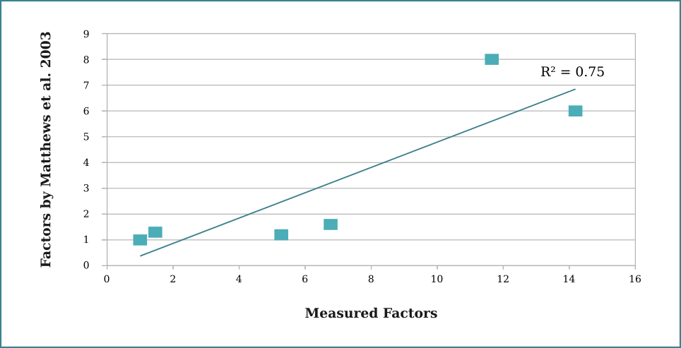
Comparison Matthews et al. 2003
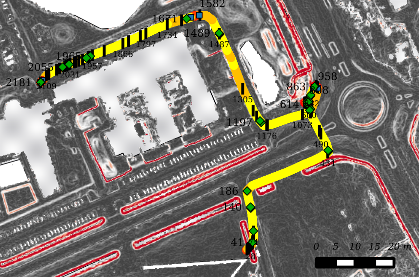
4. Comparing available and collected
Optimal circumstances
Regular walking speed, regular surface
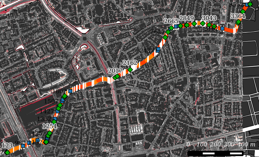
GPS + Accelerometer + Slope map
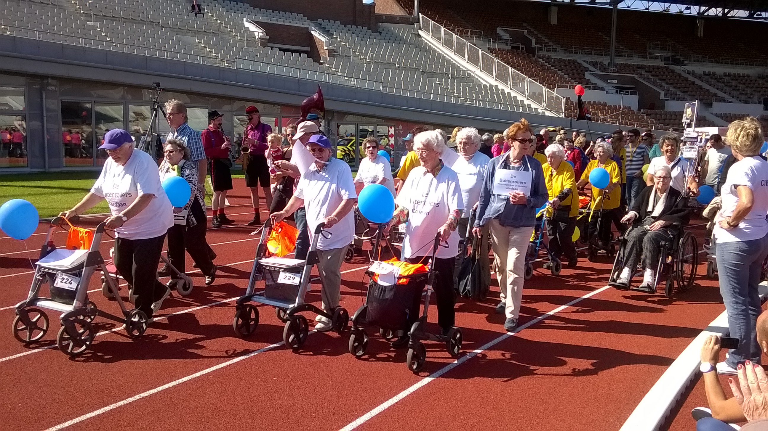
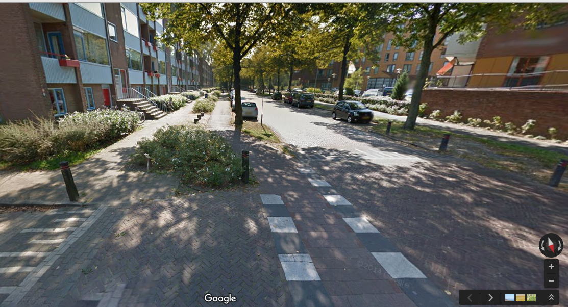
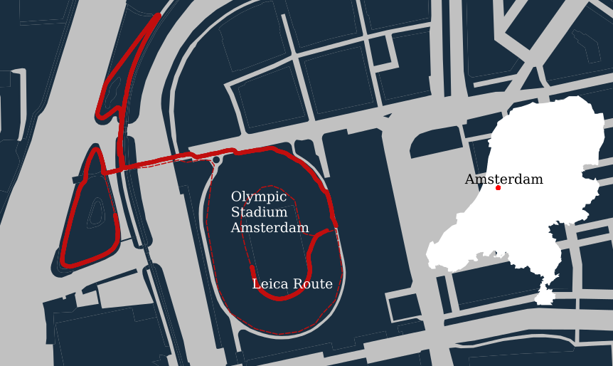
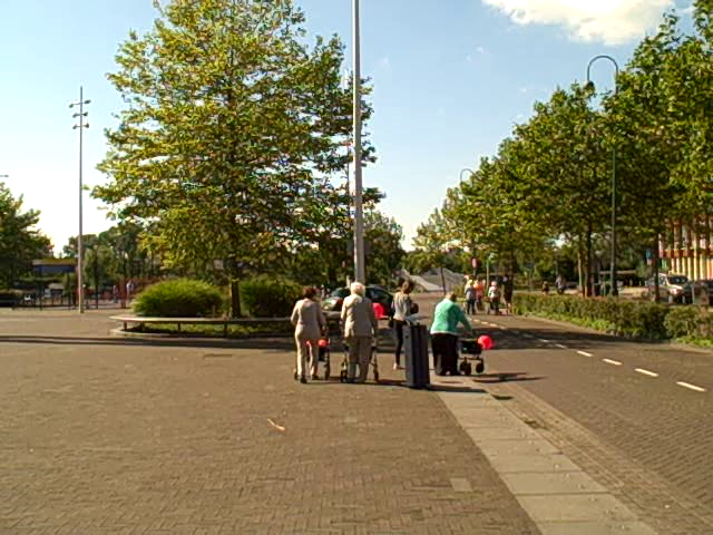
"Rollatorloop" event
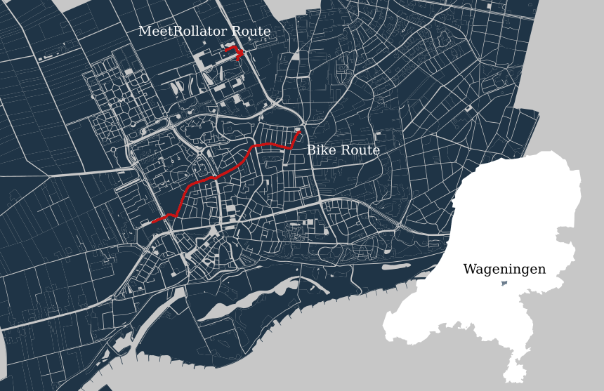
Same Set-up Rollator
Garmin
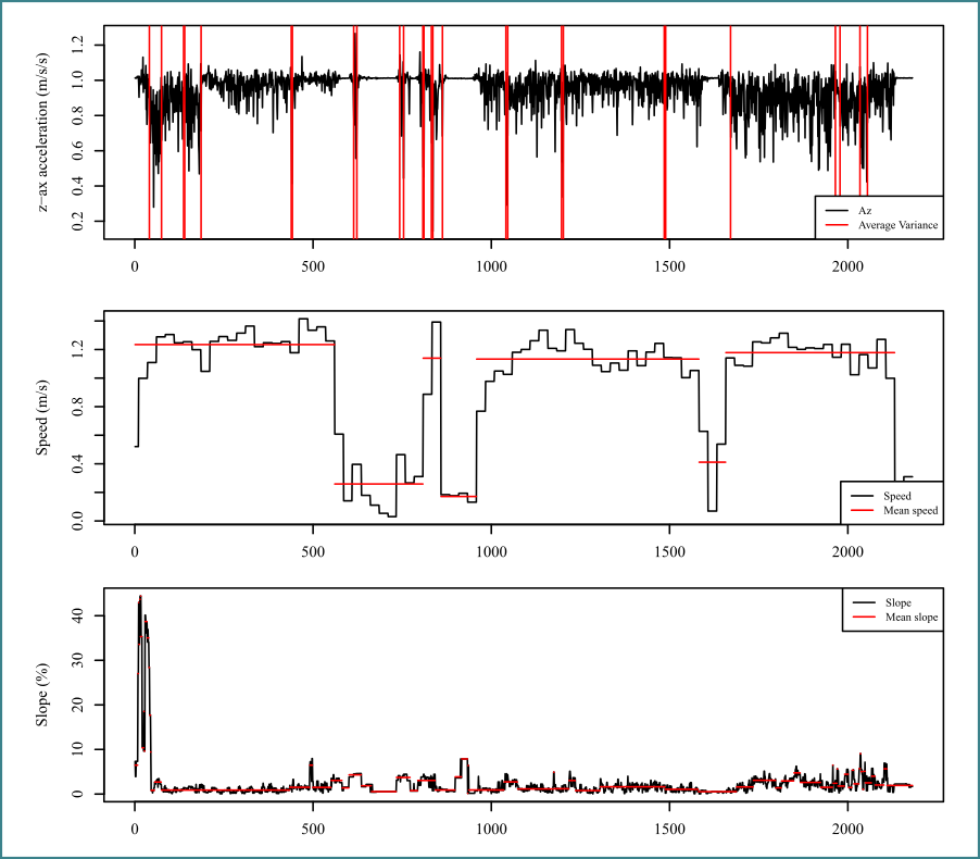
Time series
With coordinates in RDnew
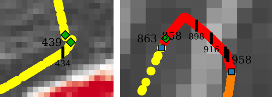
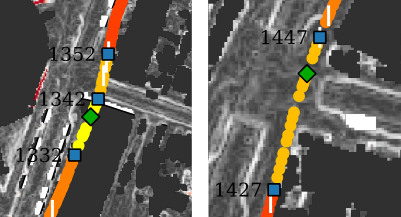
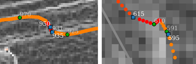
The Change Point Method
R Package developed by Killick et.al 2014
Statistical properties of characteristics change
Mean or variance


Conclusion & Discussion
Conclusions
- Confirmed that the pedestrian is forgotten.
- Mapping irregular surfaces with an accelerometer is possible.
- Comparison with changepoint method shows potential for obstacle detection.
Discussion
- Accuracy is key and critical for walkability studies.
- Accelerometer sensor quality is unknown.
- Changepoint method has more possibilities.
- Influenced experiments.